
Survey Smarter with Smart Construction Drone
- Shelley Devine
- Jul 10, 2025
- 2 min read
Updated: Aug 5, 2025
Faster topographic data. Fewer boots on the ground.
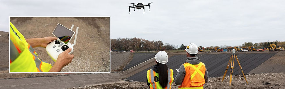
Surveying doesn’t have to slow your project down — or put your team at risk. With Smart Construction Drone, you can fly your job site in under 30 minutes and gather accurate topographic data that keeps your production moving and your planning precise. Whether you're tracking cut/fill volumes, billing by quantity, or keeping stakeholders in the loop, drone mapping is your bird's-eye advantage.
Why Should You Fly?
Drones capture hundreds of thousands of data points quickly, safely, and cost-effectively — with no need to pause production or scale steep terrain. From pre-job planning to project close-out, Smart Construction Drone helps you monitor job site activity, measure quantities, and report with confidence.
🔹 Up to 50% faster than traditional walking surveys
🔹 Fly over active job sites without disrupting crews
🔹 Capture photos, video, and map-grade point clouds
🔹 Analyze progress daily, weekly, or as needed
🔹 Integrates seamlessly with Smart Construction Office and Field
Key Features That Keep You Ahead
✅ Easier and Faster Surveys
No need to walk muddy job sites or climb steep slopes. A drone flight gives you accurate survey data in 30 minutes or less — reducing field risk and speeding up decision-making.
✅ Unlimited Tracking
Fly daily, weekly, or on demand to track quantities and job progress across all stages of the project.
✅ Minimal Downtime
Unlike ground-based methods that pause production, drone flights occur above your workflow — meaning no interruptions to your timeline.
✅ Enhanced Visibility
Generate aerial maps with hundreds of thousands of points — compared to the few hundred from a traditional survey. More data = better planning.
✅ Operational Cost Savings
Drone surveys are often a fraction of the cost of traditional methods and deliver insights faster — a win for your timeline and your bottom line.
✅ Visual Reporting from the Sky
Capture high-res photos and videos up to 400 feet in the air or underneath bridge decks. Use them for stakeholder updates, safety inspections, or site documentation.
🎥 Watch Smart Construction Drone in action: ▶️
📲 Need help starting your drone program?
👉 Contact C.N. Wood — our team and Komatsu’s technology experts are ready to support you.

Comments